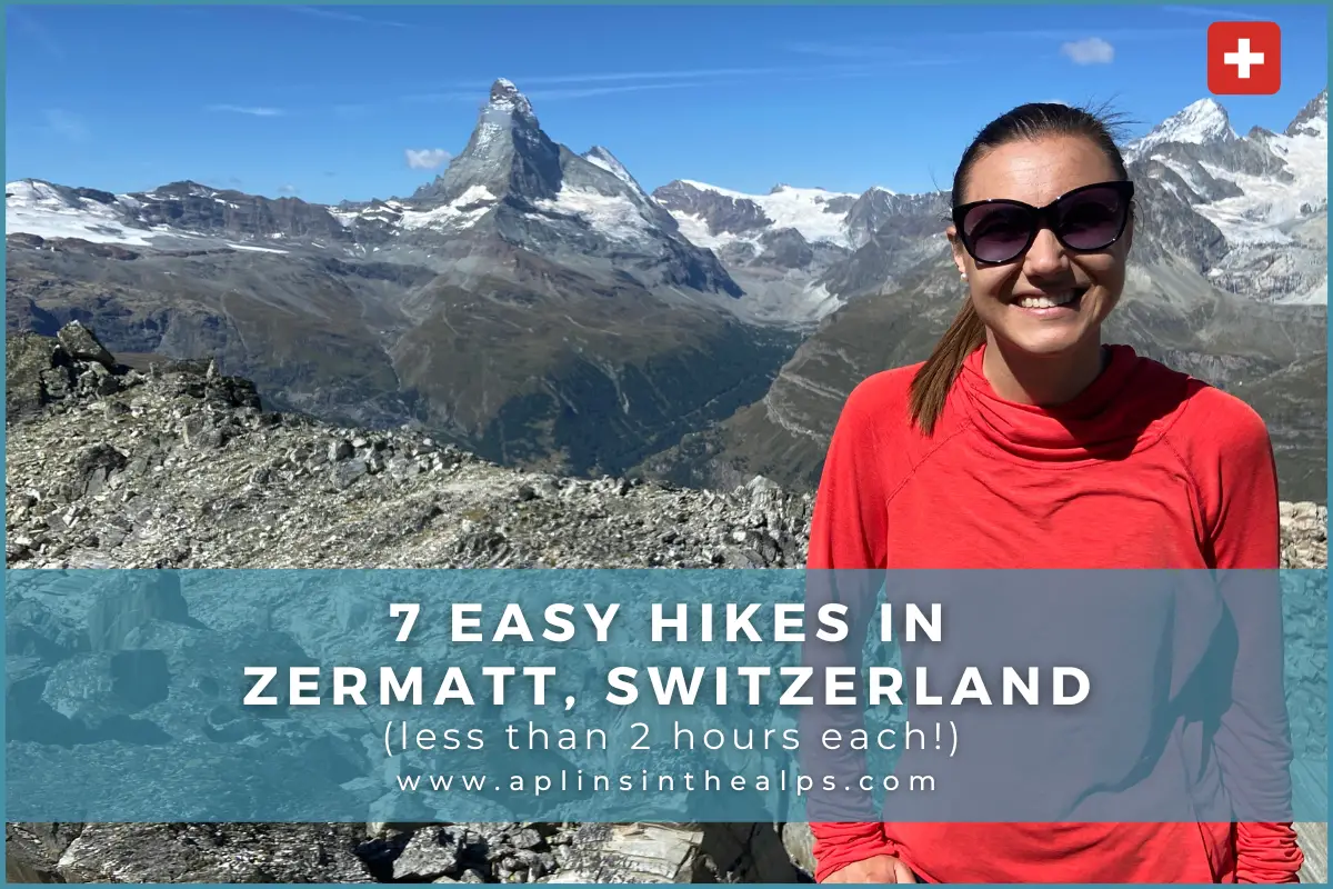
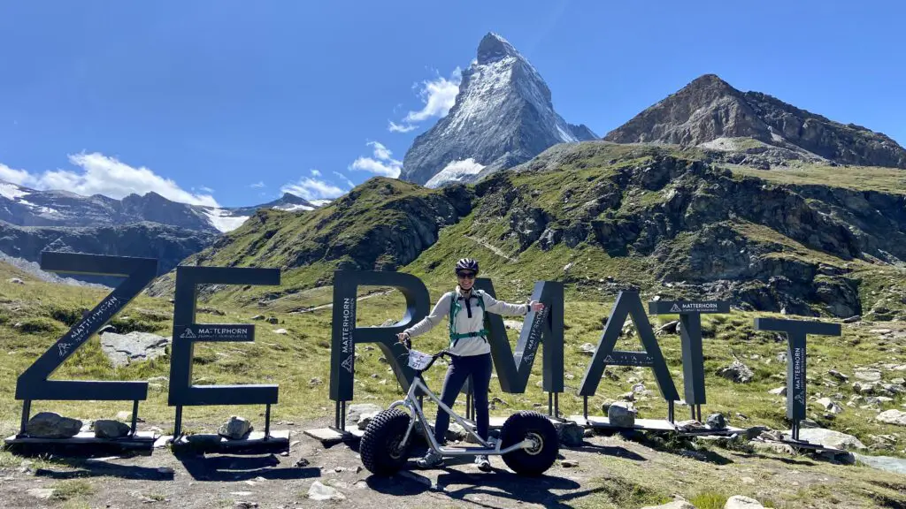
You don’t have to be a serious hiker to enjoy the natural beauty of the Matterhorn. In fact, there are countless trails and walks for all ability levels. So here are our top easy hikes in Zermatt, each less than 2 hours long.
Want to Watch instead of Read?
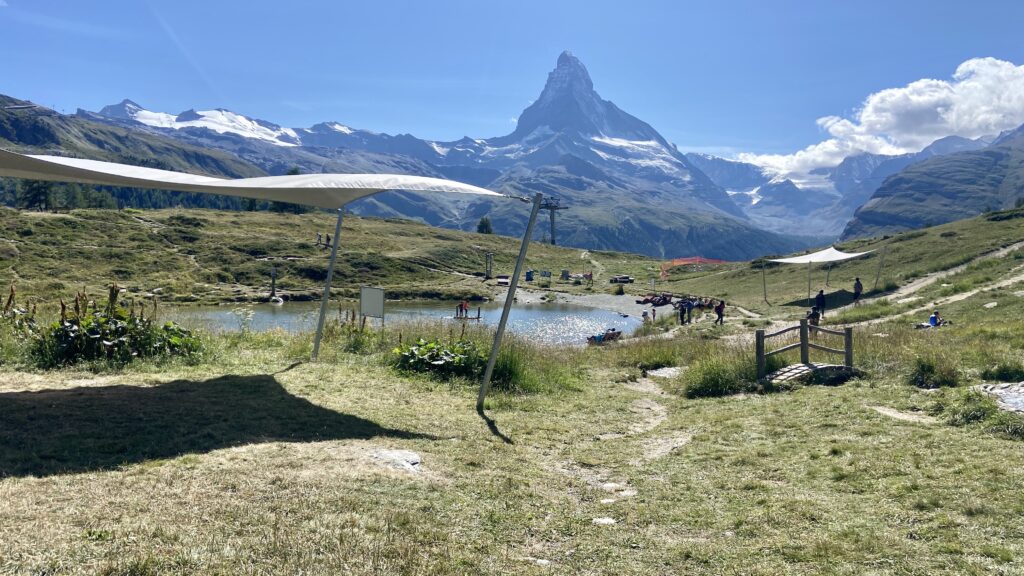
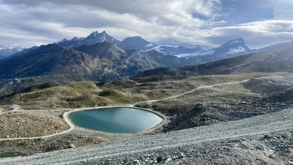
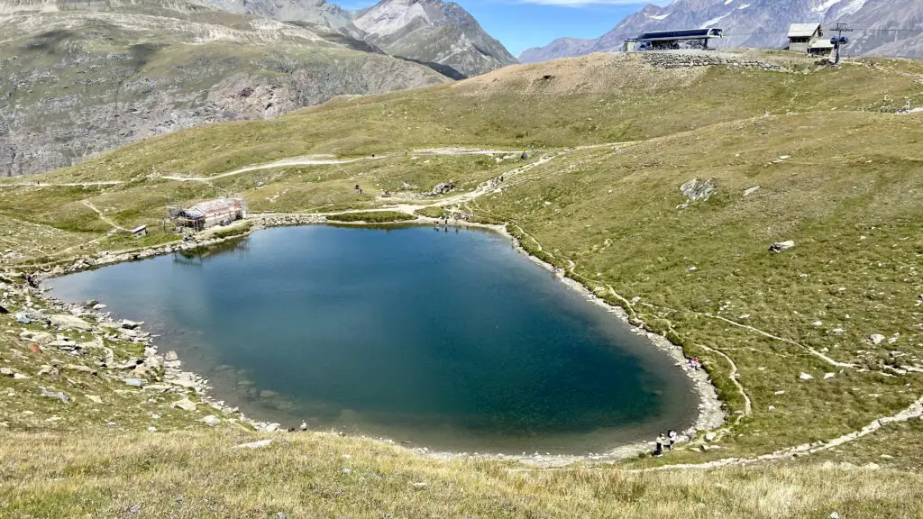
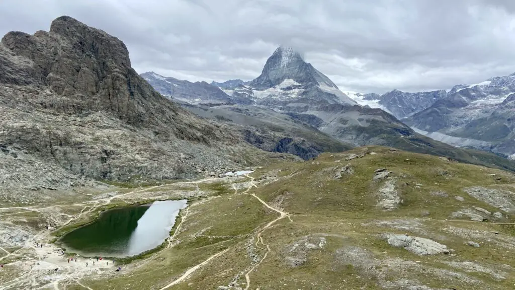
The One with Endless Alpine Lakes
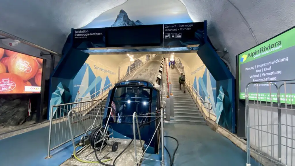
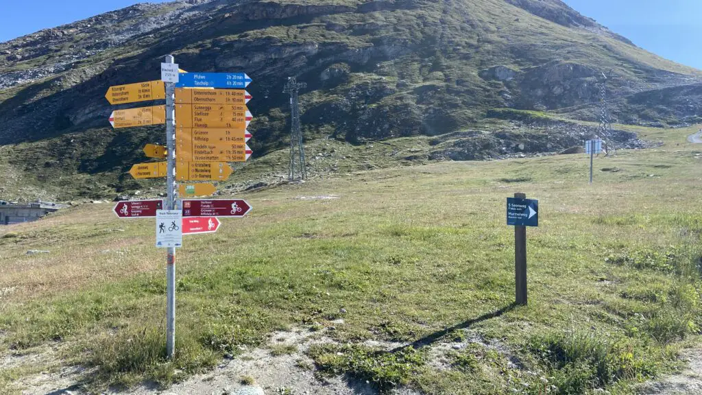
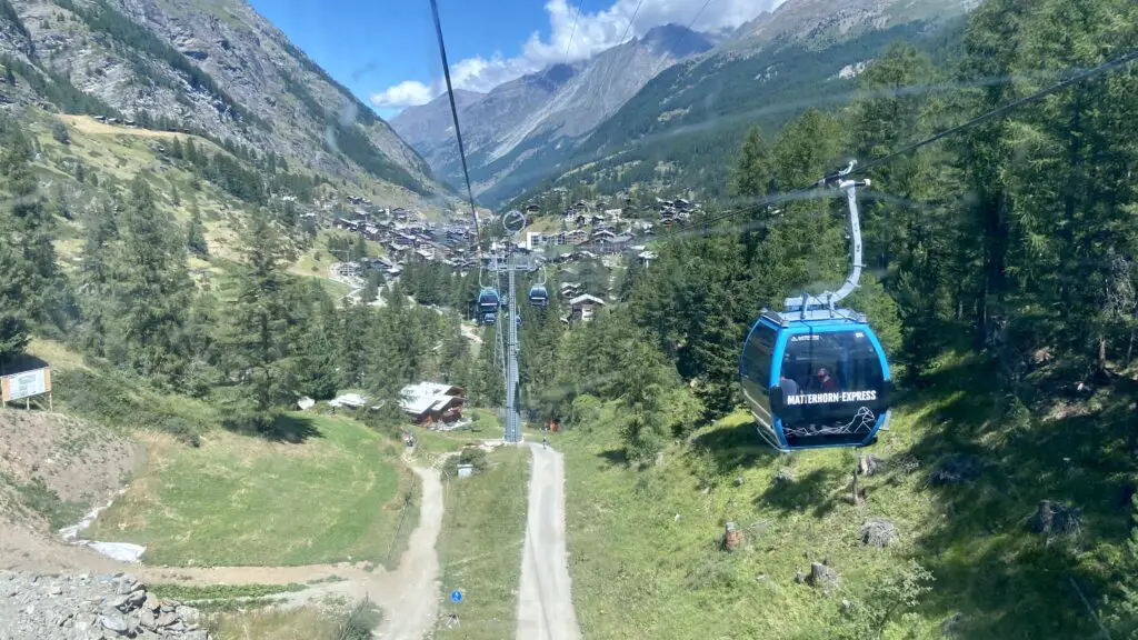
From the Zermatt train station, head downhill and across the river to the Sunnegga-Rothorn Station. Hop on Switzerland’s first completely underground funicular, then transfer to a gondola to reach Blauherd.
This place is best known for the hike we’ve called, “The One with Endless Alpine Lakes.”
You’ve probably heard of the 5-Lakes Trail, where you can see the mighty Matterhorn reflected on 3 different lakes. But the official trail is posted at nearly 10km and 2.5 hours — not exactly what we’d call an easy hike. So we recommend cutting out one or two of the lakes.
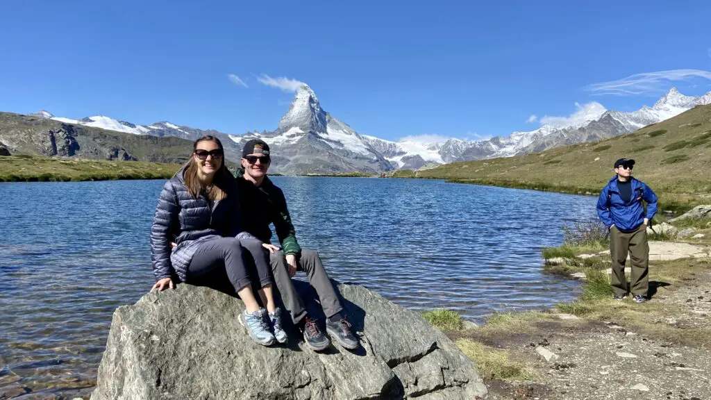
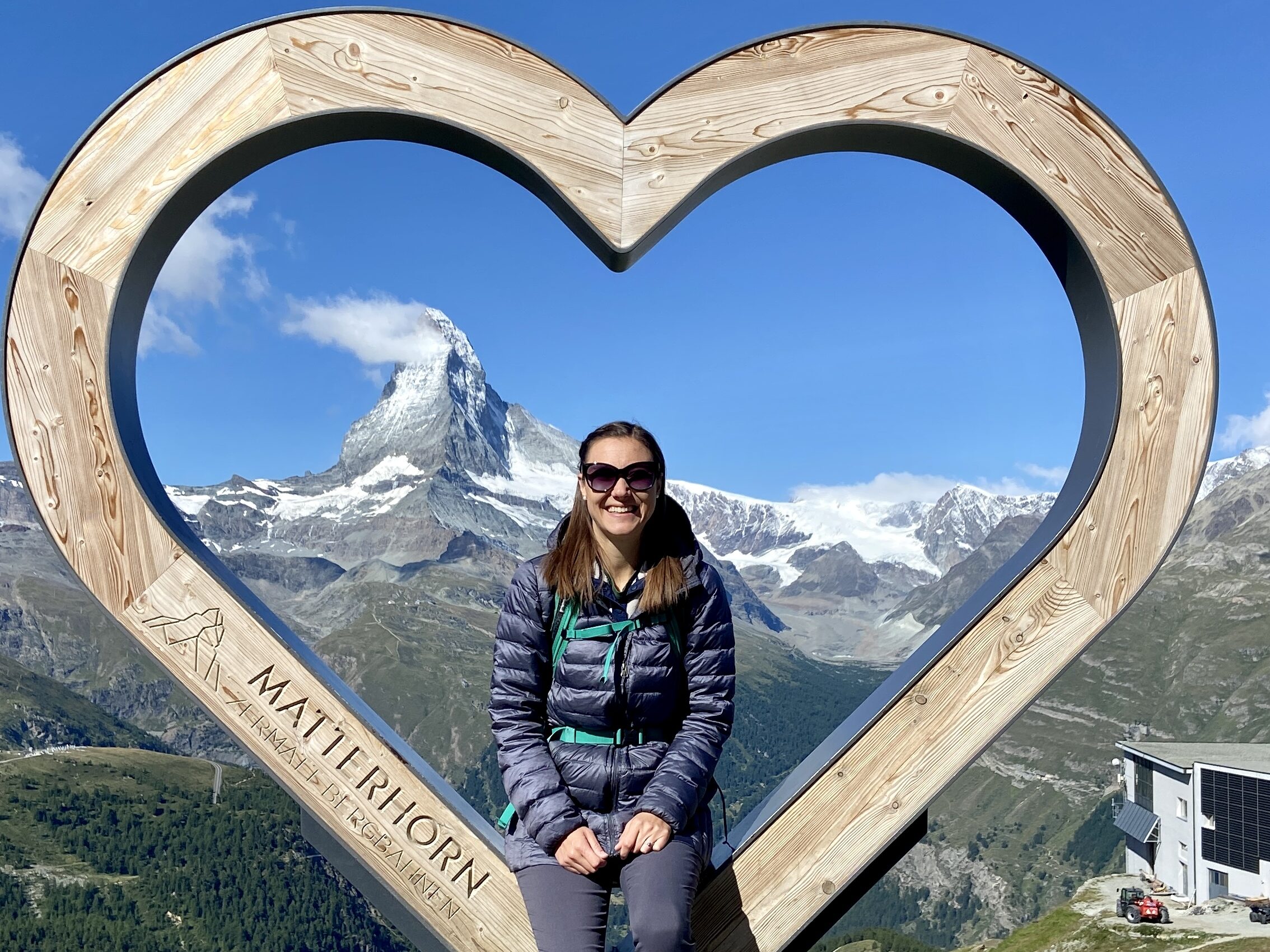
Starting from the Blauherd station, snap a quick pic with the wooden heart framing the Matterhorn, and then follow signs to Stellisee, which you’ll reach in about 20 minutes. Be sure to walk to the back of the lake for an amazing picture spot!
From this point, instead of following signs for the official 5 Lakes Trail, we recommend heading straight for Grindjisee — our favorite of the 5 lakes. It should only take about 30 minutes of actual hiking time, although you’ll probably stop every couple of minutes to take more photos — especially once you catch a glimpse of the milky teal Moosjisee far below.
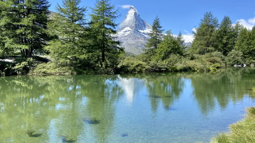
At Grindjisee, relax and soak up the beautiful scenery: green waters, green trees, green hillsides, and big rocks. Then you’ll notice the reflection of the Matterhorn and love it even more!
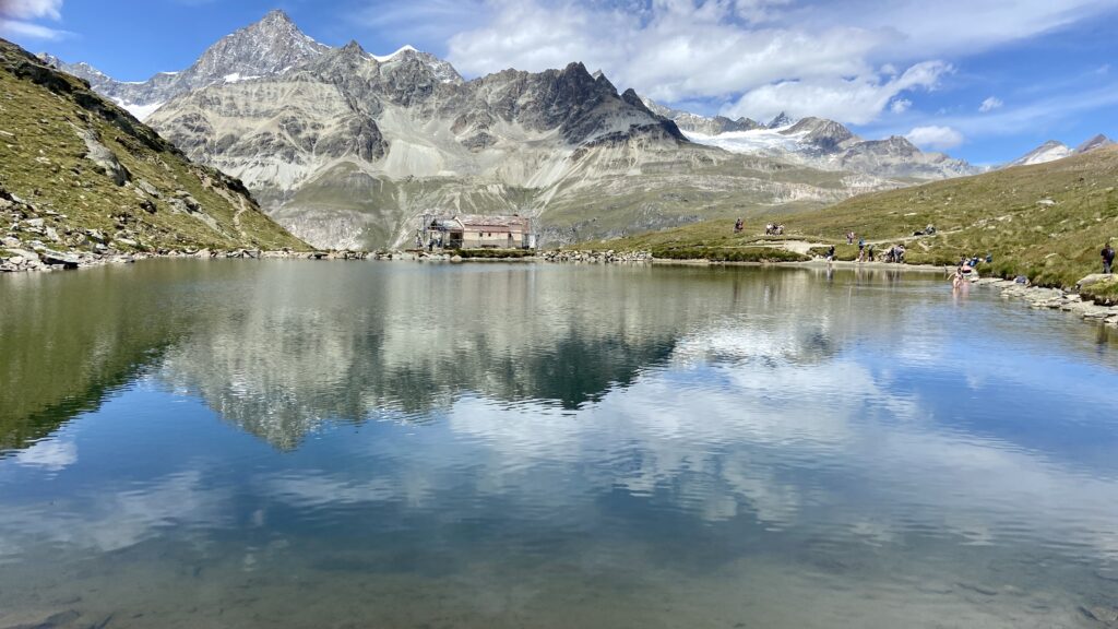
After Stellisee and Grindjisee, we think you’ve enjoyed the absolute best that this trail has to offer. So follow the signs to Leisee, the final alpine lake, also known as “Zermatt’s Beach.” There’s a raft to cross the lake, a water play area, small beach, and fun playground, all making this the perfect afternoon hangout spot for families.
Afterwards, hop on the convenient and free Leisee shuttle up to the Sunnegga station.
“The One with Endless Alpine Lakes” is posted at 4.6km and takes about an hour and 20 minutes.
The One for Everyone
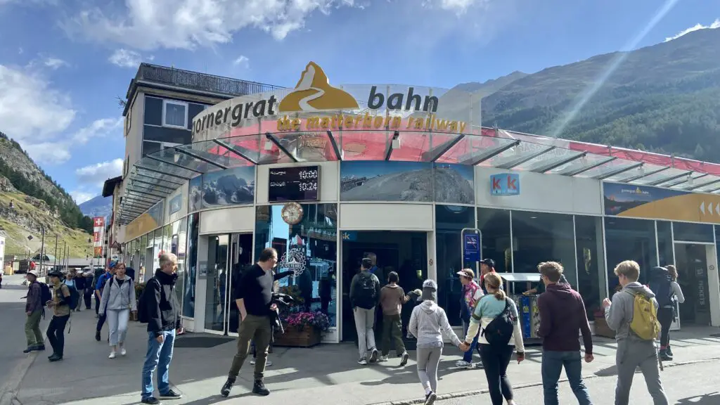
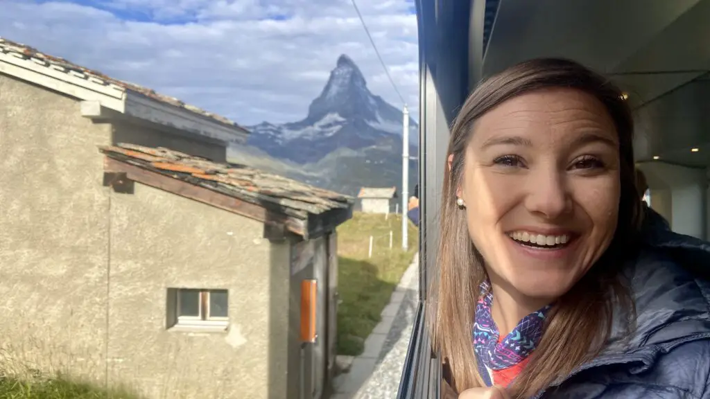
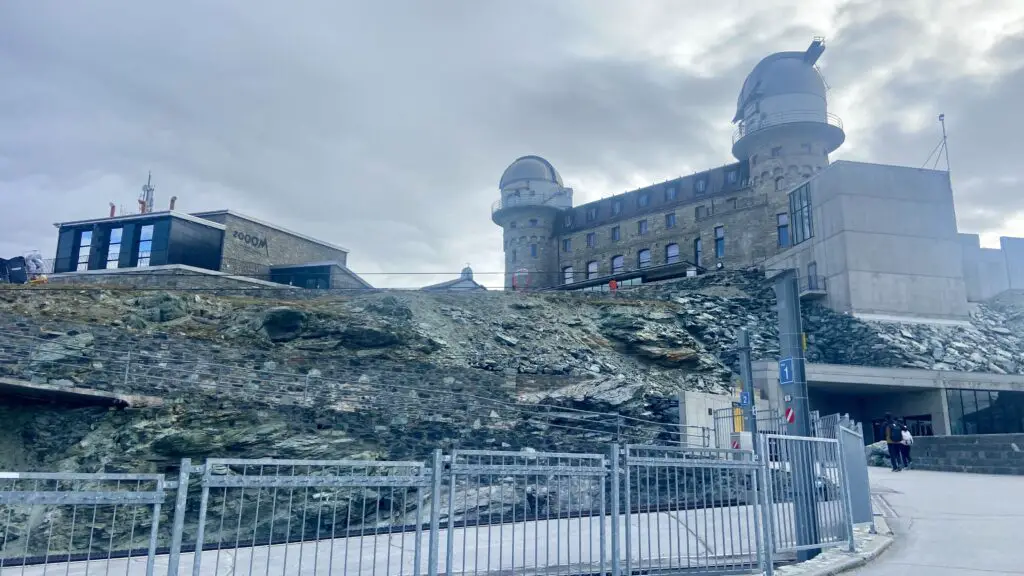
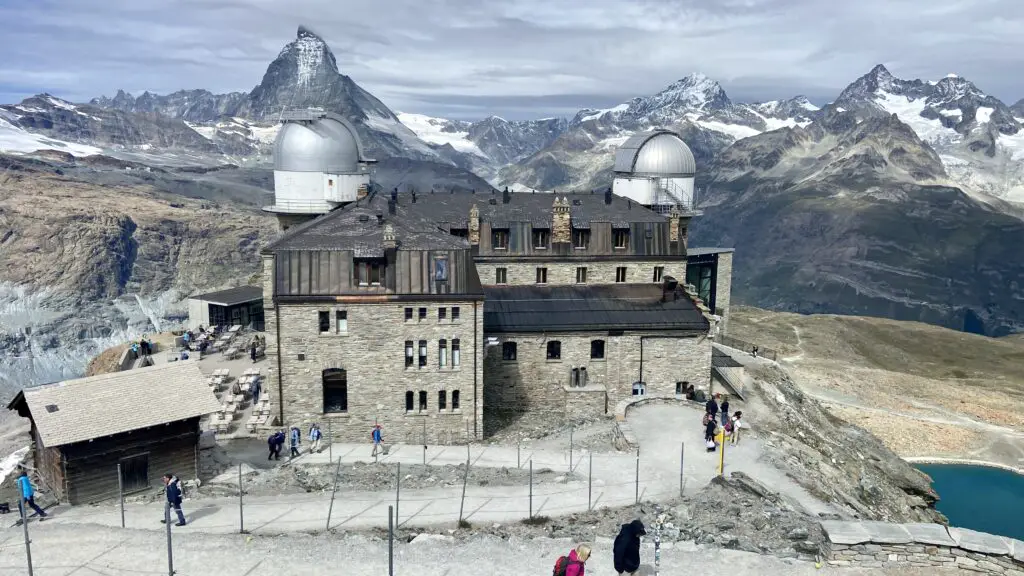
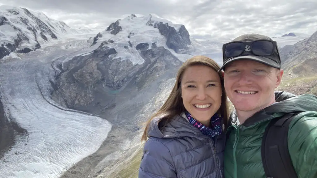
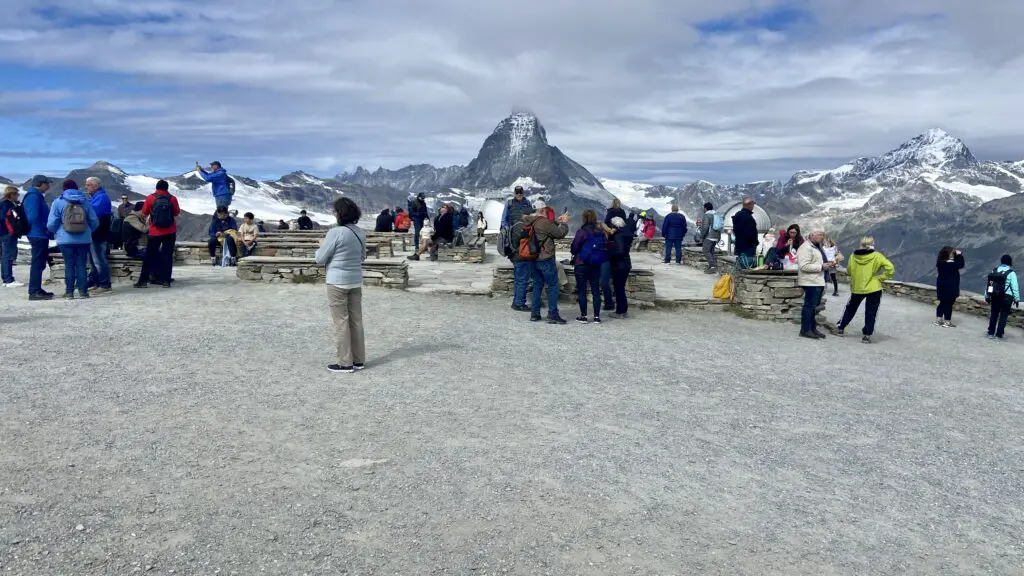
A stunning 33-minute scenic train ride climbs 1469 meters past bridges, tunnels, forests, and mountain lakes. After 9.4 kilometers of alpine bliss, you reach Gornergrat.
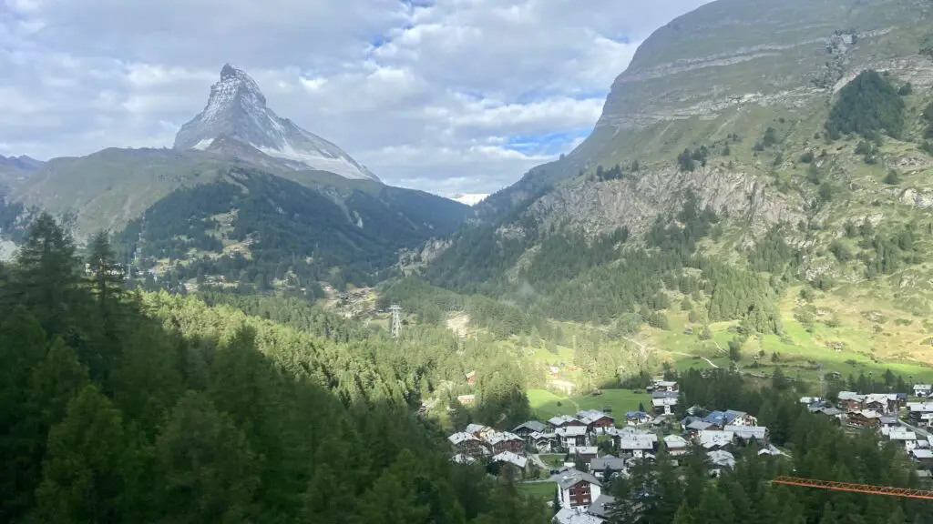
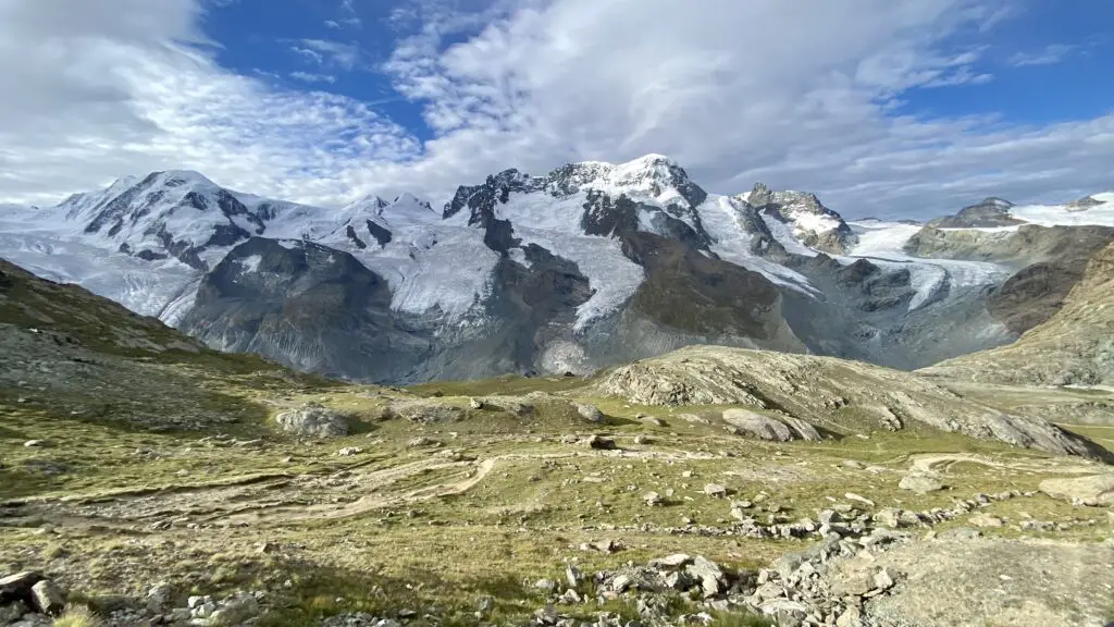
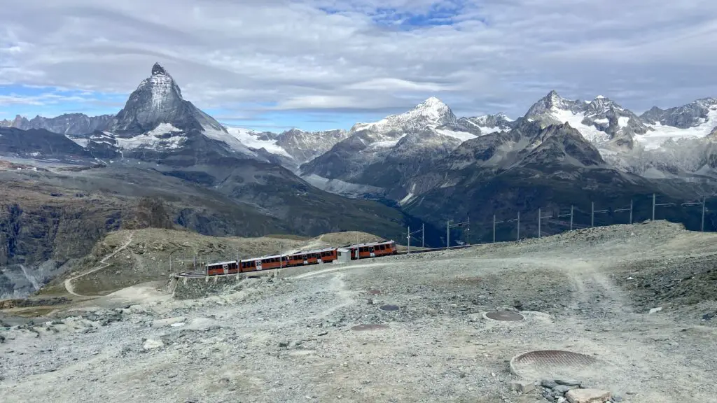
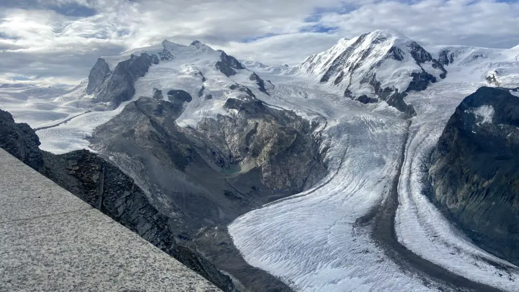
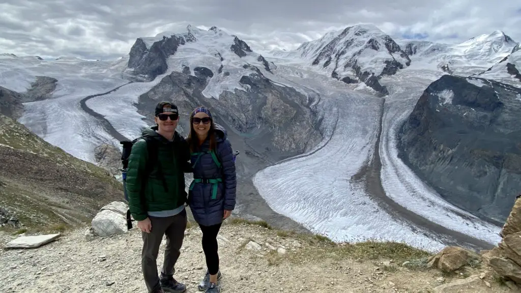
This is our absolute favorite excursion from Zermatt because once you’re there, there are endless sparkling glaciers and impressive mountain peaks as far as your eyes can see.
But the best place to soak in all of these views is the short, panoramic hike we’ve called “The One for Everyone.”
Head behind Europe’s highest hotel to find the path, which is #16 on the Zermatt hiking map. A nicely beaten trail gently loops around with just a few meters of elevation change, offering the best ratio of scenery-to-effort that you’ll probably find anywhere in Zermatt!
Along the way, look for…
- The shiny Monte Rosa hut
- Dufourspitze, Switzerland’s highest peak
- Gorner Glacier, the second highest glacier in the Alps
- And, of course, the Matterhorn!
The trail ends at a big overlook so you can keep absorbing the panoramic views.
A visit to Gornergrat pairs well with hike #5 on this list, or a visit to any of the stops along the Gornergrat Railway. In particular, Riffelalp is our favorite, but we explain why all of them are worth a visit in our 3-Day Guide to Zermatt.
The “one for everyone” is posted at only half a kilometer long and takes just 20 minutes.
Ready to hike in Zermatt?
If you’re ready to lace up your boots for a hike in Zermatt, you can find out how to fit these hikes into your itinerary using our 3-Day Guide to Zermatt, which includes custom hiking maps!
The One at the Base of the Matterhorn
Glacier Paradise needs no introduction! It’s the highest cable car station in Europe, the highest viewing platform in Europe, and the highest movie theater in Europe. And you can even ski 365 days a year, and walk 15 meters below the surface of a glacier!
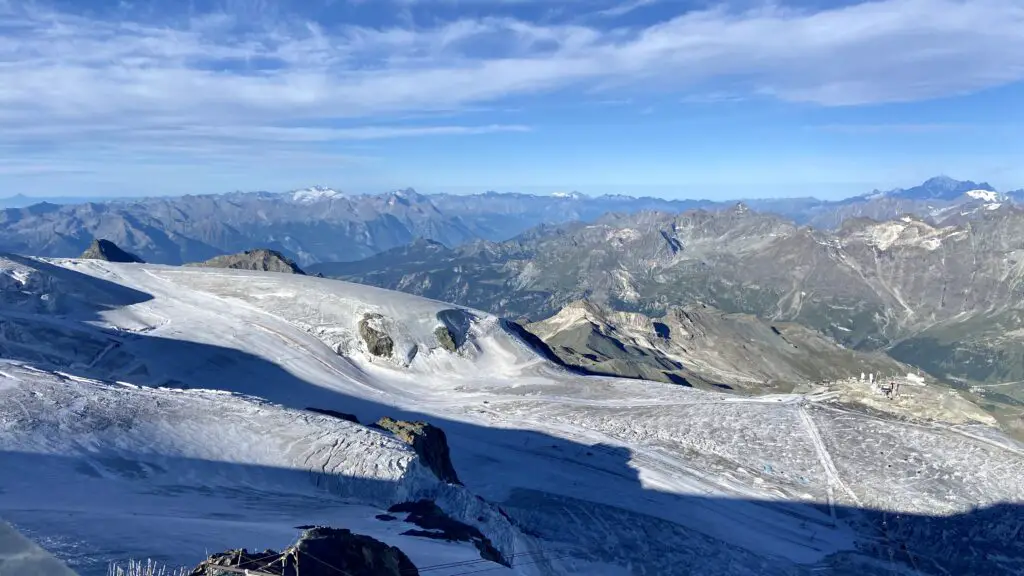
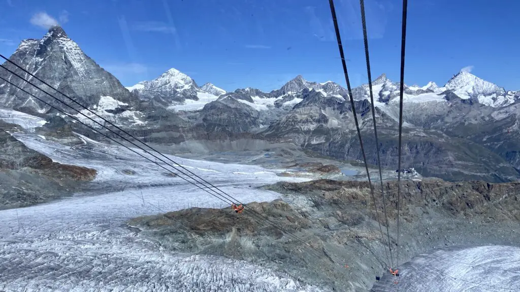
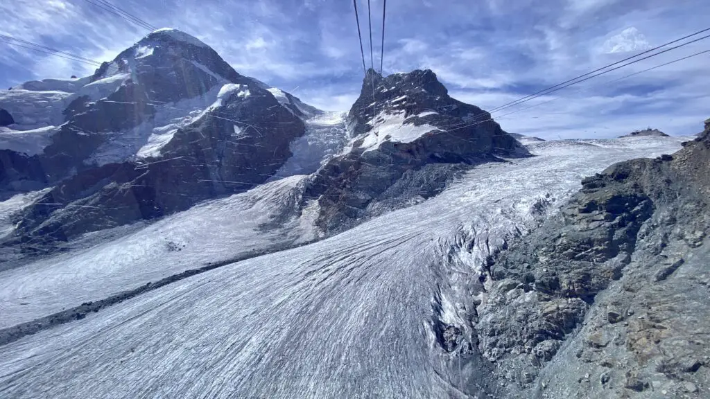
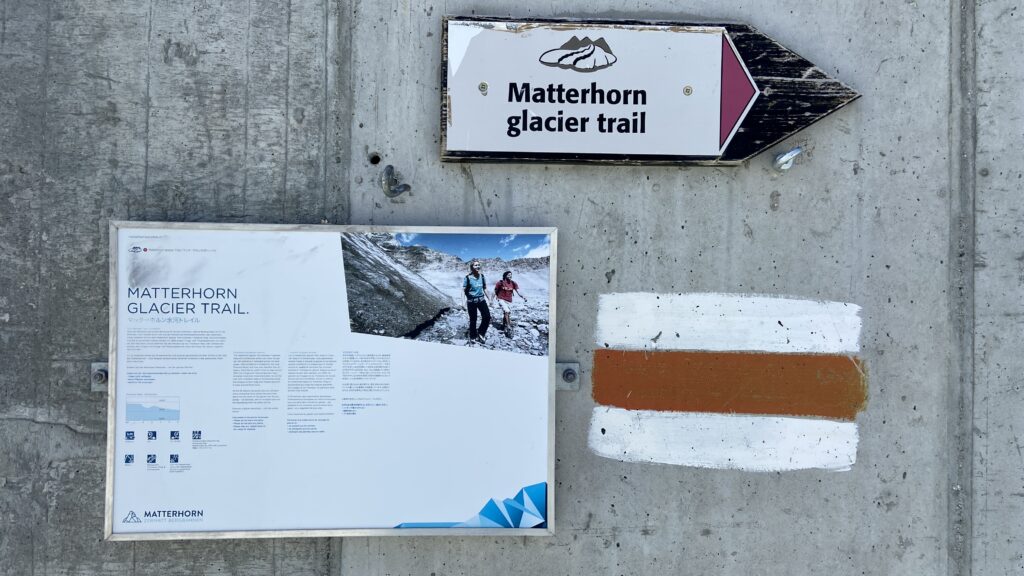
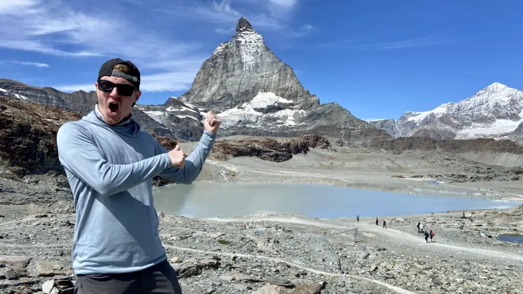
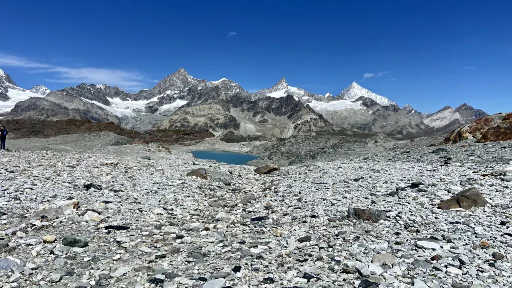
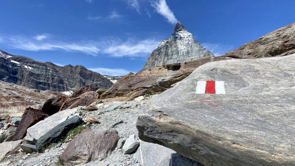
But a short cable car ride down from Glacier Paradise is Trockener Steg, where you’ll start the hike we’ve called, “The One At The Base of the Matterhorn.”
Exit out the back of the station and look for signs for the Matterhorn Glacier Trail, #26 on the Zermatt hiking map. After just 5-10 minutes of gentle, downhill hiking, you’ll reach yet another lake where you can enjoy a beautiful Matterhorn reflection.
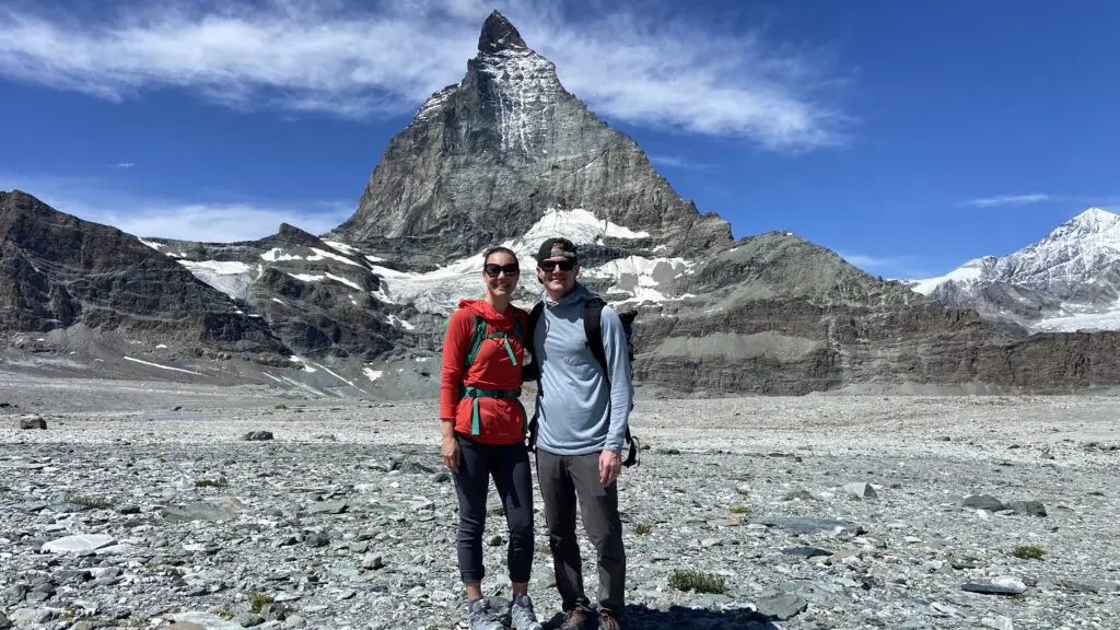
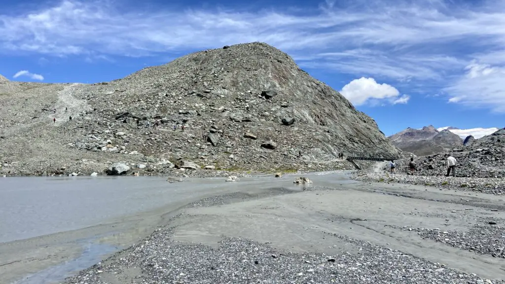
Since 1850 when the Little Ice Age ended, the Furgg and Theodul Glaciers have receded more than 3 kilometers, exposing the trail you’re now walking on. During the next 2 hours, you’ll have the opportunity to see glacier streams, rocks of almost every color, and imposing views of the Matterhorn. And there are 23 info panels along the way if you’re interested in learning more about the geology of the area.
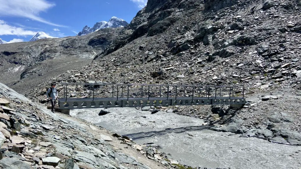
About two-thirds of the way into the hike, there’s a pretty steep hill to climb up. And at the top, the trail intersects with the alpine trail to the Hörnlihütte, which is where climbers spend the night before attempting to summit the Matterhorn.
Then there’s a steep descent to Schwarzsee, where another alpine lake and a photo spot in front of the Zermatt sign await you.
Admittedly, this is the least easy trail on this list due to the high elevation, rocky terrain, and steep uphill and downhill sections. “The One At The Base of the Matterhorn” is posted at 6.6km, and takes about 2 hours.
The One for Foodies
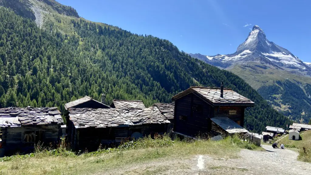
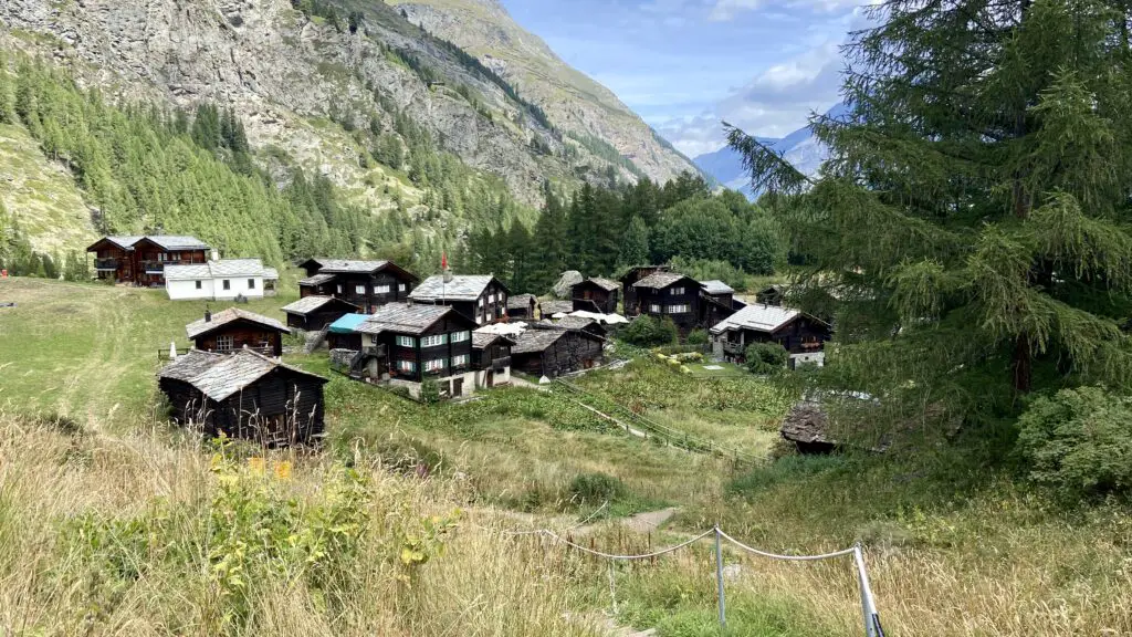
Zermatt has been called the best culinary village of the Alps. But if you’re coming here for the amazing food, you don’t just have to stick to the village! You can head up to Findeln, a tiny hamlet just below Sunnegga, to enjoy the hike that we’ve called “The One for Foodies.”
Starting from the Sunnegga station, ride the Leisee shuttle down to the lake and follow signs to Findeln. We’re not sure how it happened, but this place has become a pilgrimage for foodies, with restaurants that collectively boast 42 Gault Millau points — which basically just means they’re really, really good!
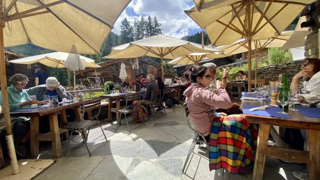
A short loop from Leisee will take you to some of our favorites — Chez Vrony, Paradise, and Adler Hitta — while helping you burn some calories and make room for more! And we definitely recommend making reservations in advance.
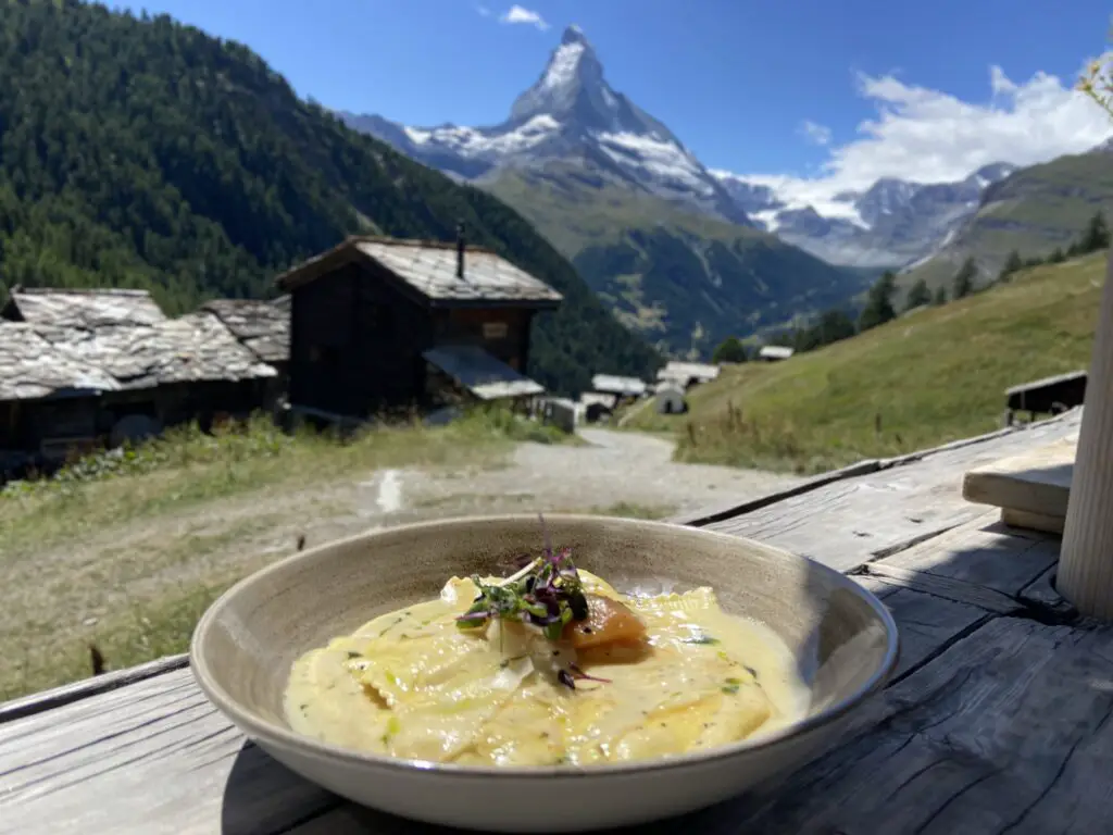
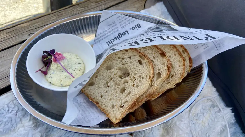
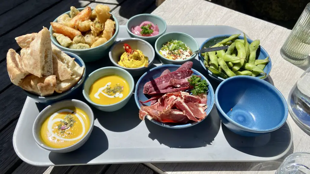
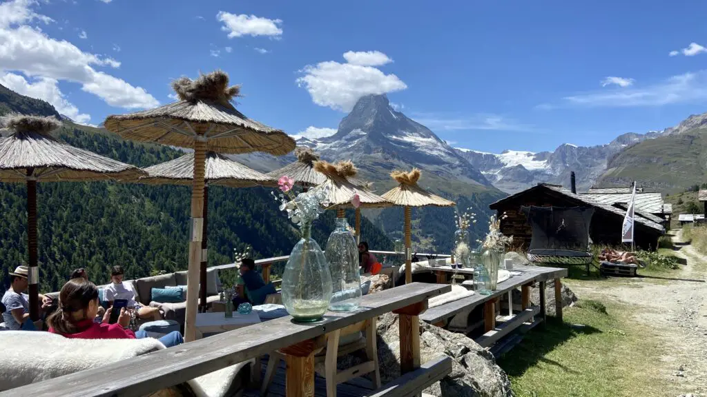
You can craft your own progressive, multi-course meal, bouncing from one restaurant to the next, sampling some of the tastiest cuisine you’ll find anywhere in Switzerland while enjoying the icing on the cake — sunny terraces with majestic Matterhorn views.
“The One for Foodies” is posted at 2.8km and takes just 1 hour — with food breaks along the way of course!
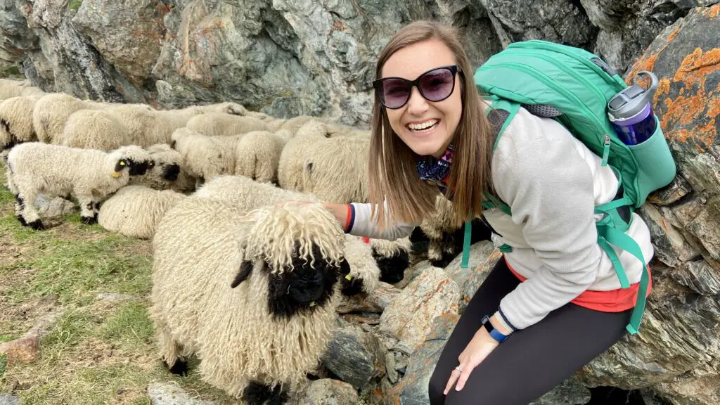
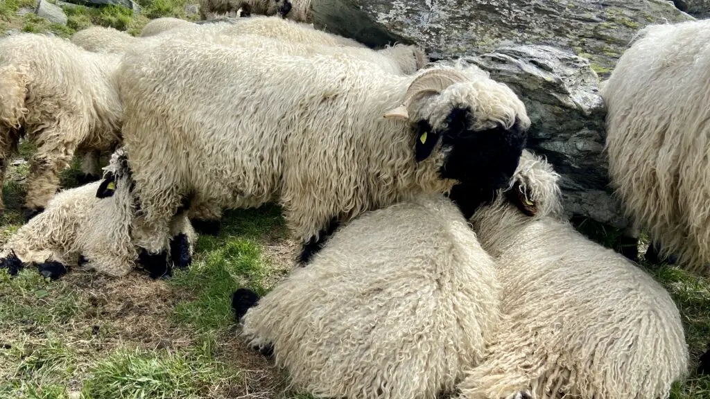
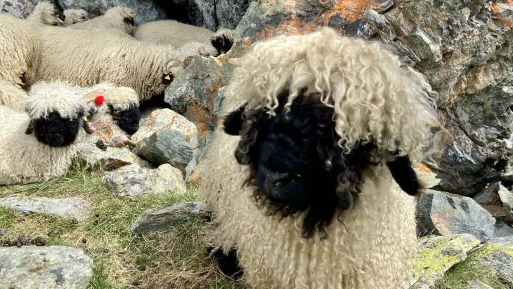
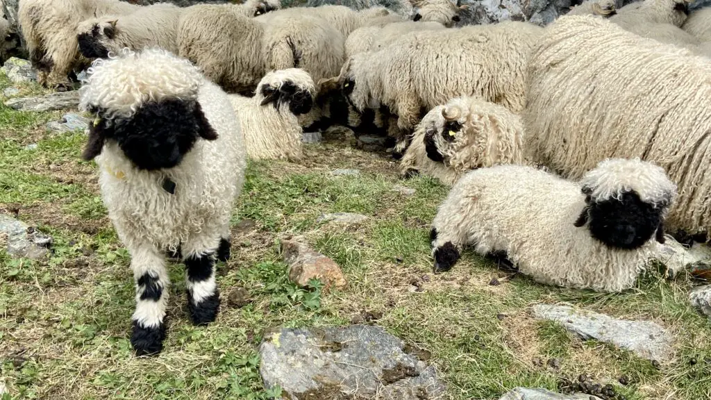
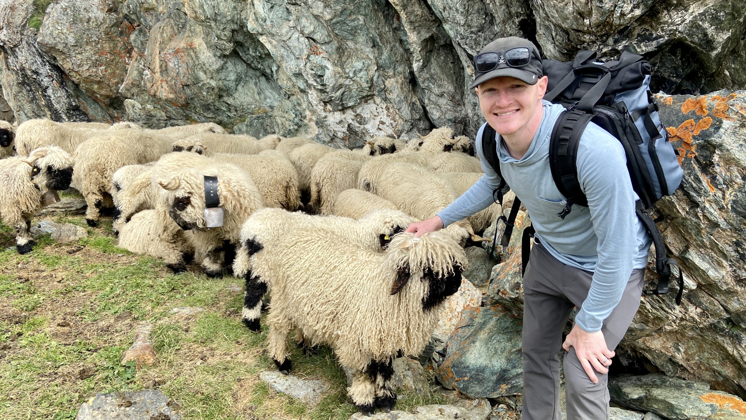
The One with the Blacknose Sheep
On the train from Gornergrat back toward Zermatt, you’re gonna wanna hop off at Rotenboden, the first stop, to explore a bit more!
Just below the train station is Riffelsee, another alpine lake known for its beautiful Matterhorn reflections on a clear day. But that’s not all there is to see from Rotenboden, which is also the starting point for a hike we’ve called, “The One with the Blacknose Sheep.”

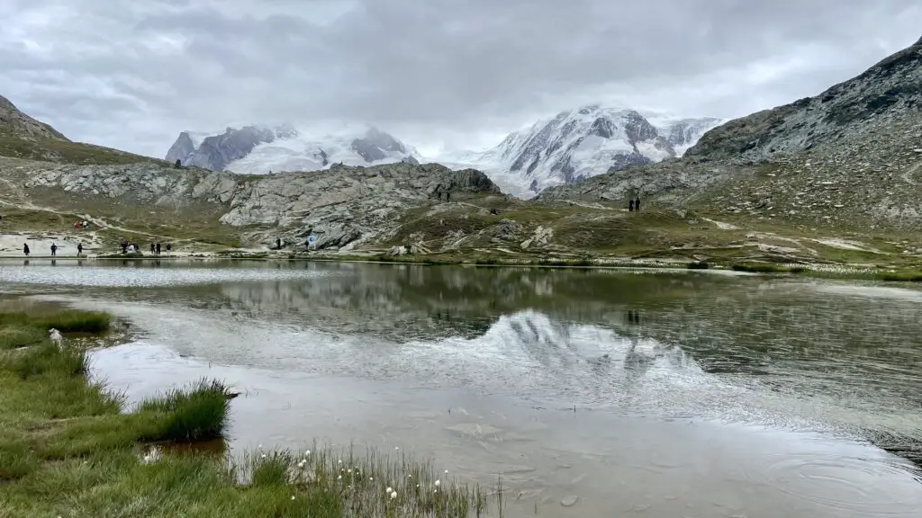
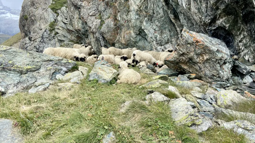
Walk past Riffelsee, basically hiking toward the Matterhorn. At this point, you’re already part way into the official “Meet the Sheep Trail”, which actually started all the way up at Gornergrat.
But before you get too far, pull out your phone. First, you can scan the QR code on the signs along the way to learn more about the famous blacknose sheep. Then, find out where they’re grazing in real time at https://sheep.gornergrat.ch/en/map!
This unique breed of sheep nearly went extinct in the mid-1900s. They’re hardy enough for the mountain terrain yet cuddly and fluffy too. And now you can pet them along the trail and even meet their shepherdess! It’s easiest to find them here from 10am to 4pm, from June to September.
After your short detour to visit these friendly, furry little creatures, follow signs to Riffelberg, where you can watch paragliders take off, grab a bite to eat, or continue on the train down to Zermatt.
“The One with the Blacknose Sheep” is posted at 3.1km along trail #21, and takes just 55 minutes.
The One for a Cloudy Day
Hopefully you have sunny skies to see the Matterhorn, but even if the weather doesn’t fully cooperate, you still have options to make the most of your time, including this hike we’ve called “The One for a Cloudy Day.”
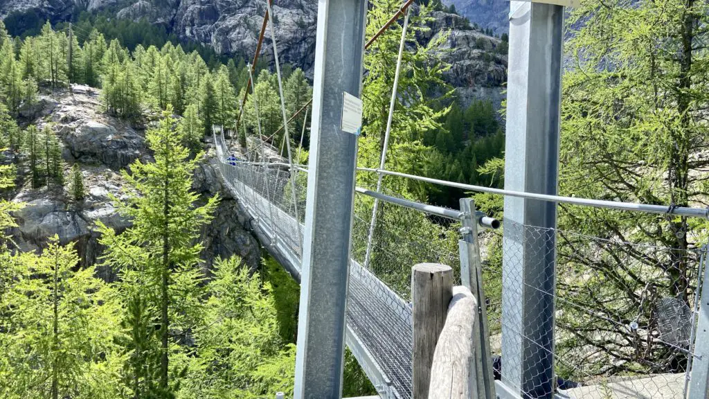
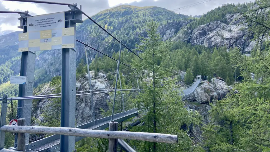
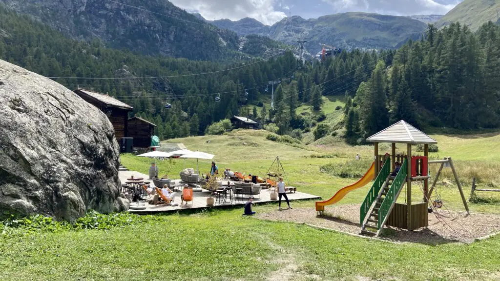
Starting from the Glacier Paradise valley station, ride the gondola for 10 minutes up to Furi, and then follow signs for the “Hängebrücke.” It should take about 20 minutes to reach this 100-meter long bridge gently swaying 90-meters over the Gorner Gorge below.
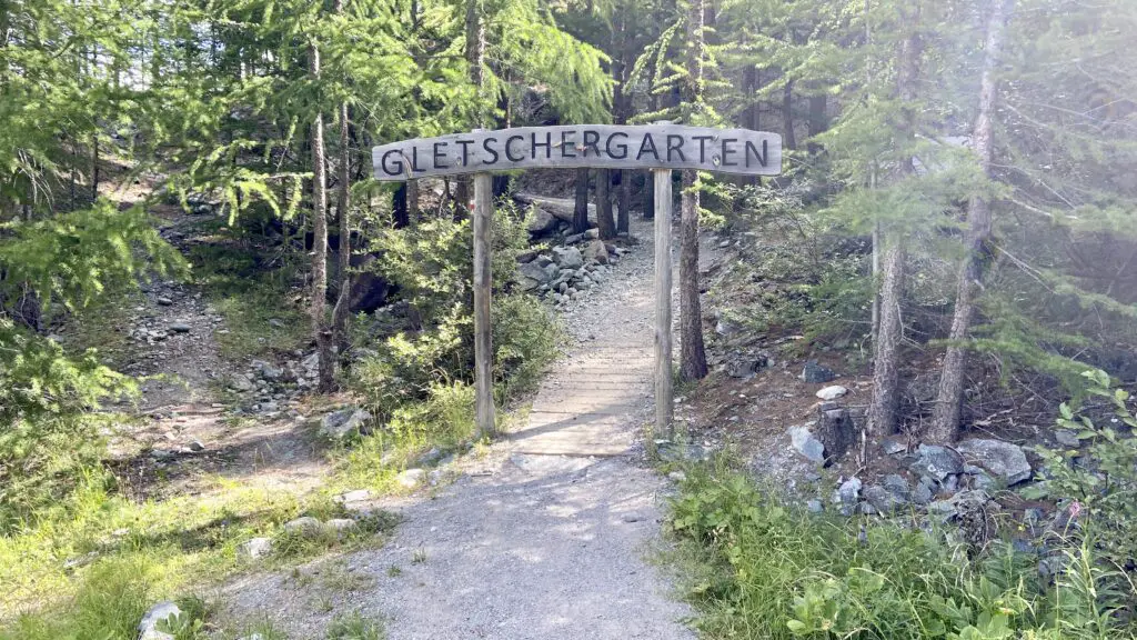
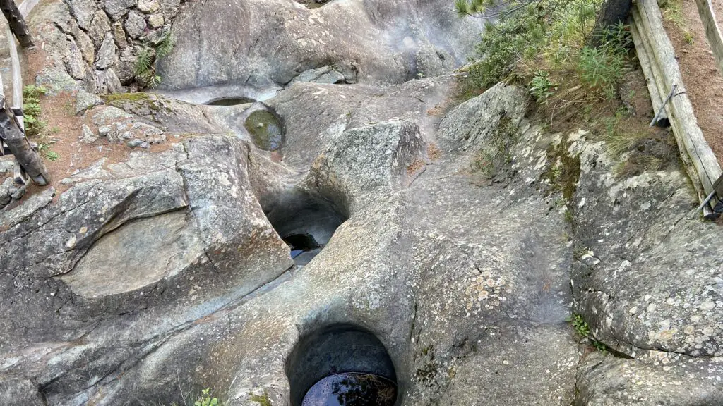
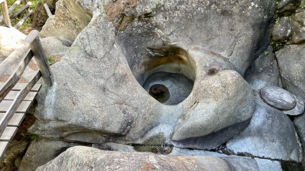
After you cross the bridge, walk another 10 minutes, passing a playground to reach the Glacier Garden. Then follow the circular loop with info signs along the way, but here’s a quick summary: A long time ago, the tip of the Matterhorn was part of the ocean floor and most of Switzerland was covered by glaciers. Sandy water whirled around in the glacier’s rock to form these smooth potholes, which weren’t discovered until 1966.
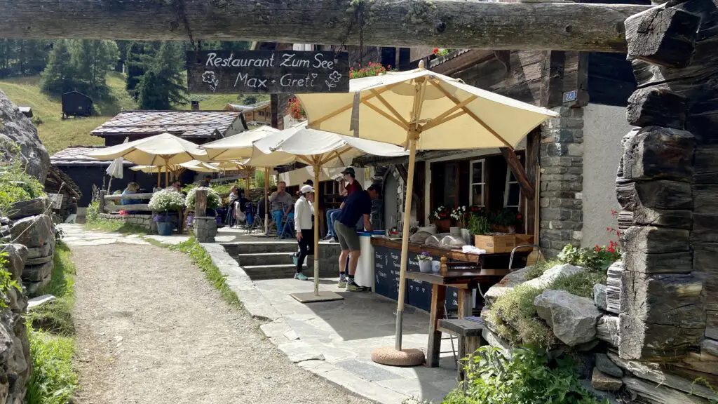
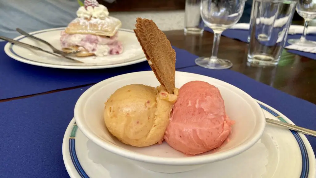
After you’ve finished exploring, walk the same trail back across the suspension bridge to Furi, and then follow signs to Zum See, which is about a 15 minute walk gently downhill. This is a tiny hamlet of wooden buildings and a large community garden. Let your ears and nose guide you to Restaurant Zum See, a perfect spot for a local lunch.

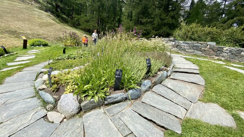
When you leave the restaurant, follow the yellow trail signs to Blatten by walking through the forest, then veer to your right to see the Ricola Herb Garden. Even if you’re not into gardens or cough drops, it’s still worth a peek. You can see a handful of the plants here, but of course Ricola’s original recipe is a secret. And don’t leave here without hollering a playful “Ricolaaaa”!
Next, feel free to stop at Restaurant Blatten, or continue on the trail to Gorner Gorge, which is just 12 minutes away. You’ll descend down wooden stairs to enter the gorge. At each platform, peer over the edge to really appreciate the deep walls and rushing water below. It takes about 20 minutes to walk the entire length, and you’ll have to pay an admission fee when you exit (since the gorge can be accessed in both directions).
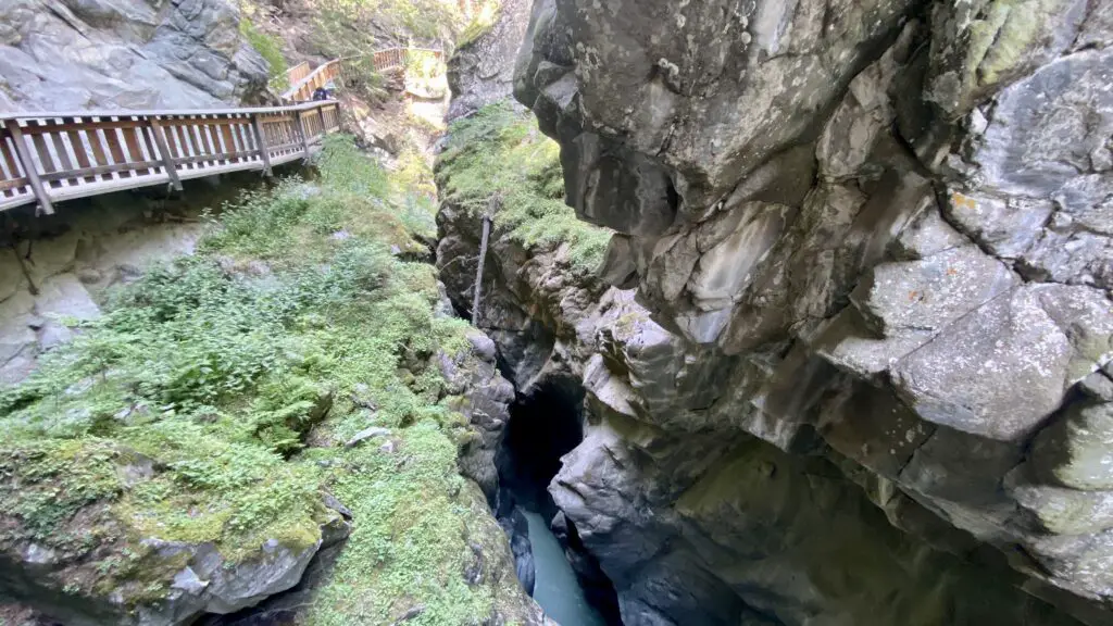
Once you leave the Gorge, turn right and walk 13 minutes until you reach Zermatt village.
“The One for a Cloudy Day” is posted at 6.1km and takes an hour and 45 minutes.
The One on an Alpine Ridge
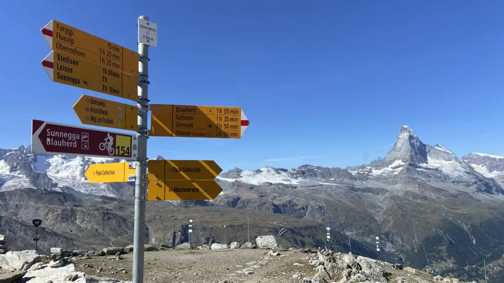
The Sunnegga-Rothorn transportation line has three possible destinations, including Sunnegga (which is the starting point of “The One for Foodies”) and Blauherd (where you’ll begin “The One with Endless Alpine Lakes”).
But continue by cable car from Blauherd to reach the top station, Rothorn, perched at nearly 11,000 feet. And while there’s not much to do up here, you’ve come for what might just be Brett’s favorite hike in the entire area — “The One on an Alpine Ridge.”
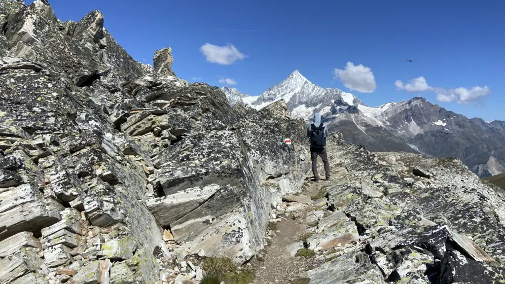
From the station, head down under the cable car lines to follow the Adventure Trail, listed as #1 on the Zermatt hiking map. A quick descent followed by a short climb will deliver you to the Ritzengrat — an alpine ridge offering dazzling views of the Matterhorn and Weisshorn and Zermatt village below.
Some spots are a bit rocky, but for the most part the trail is pretty easy — as long as you can handle the 500 meters of descent! More than any other hike near Zermatt, this was fun not just because of what we could see from the trail, but because the hiking itself was so unique and enjoyable.
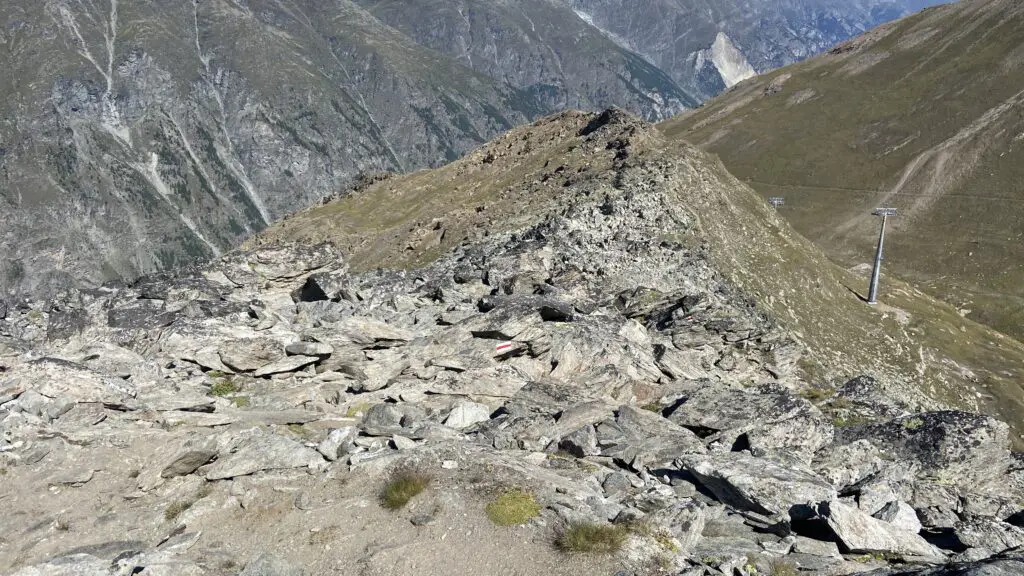
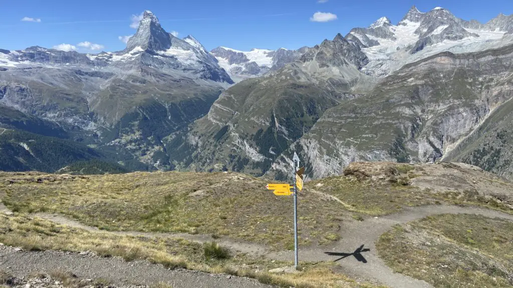
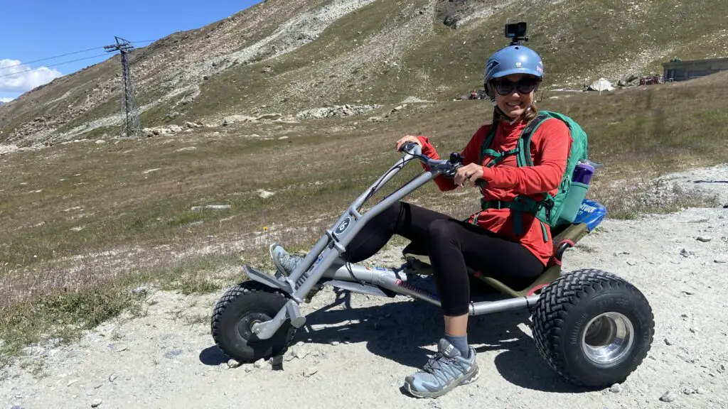
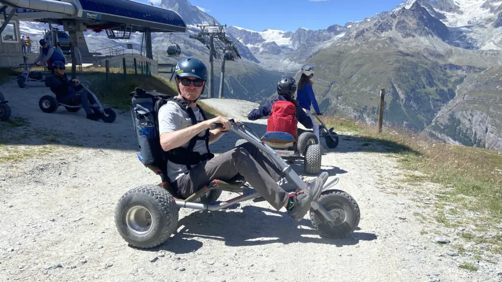
Continue downhill, and after about 1.8km, you’ll reach a trailhead, where we recommend turning left to continue on the Panorama Trail to Blauherd, #9 on the Zermatt Hiking map. The Matterhorn views are non-stop from here. Once you reach Blauherd, plenty more high mountain adventures await, including the 5 Lakes Hike and the high-speed Mountain Carts to Sunnegga.
“The One on an Alpine Ridge” is posted at 3.7km, and takes just 1 hour 15 minutes.
Ready to fit these hikes into your Zermatt itinerary?
Wondering how to fit these fantastic hikes into your trip? Well, we’ve got you covered with our 3-Day Guide to Zermatt! Many of these hikes are featured, including custom hiking maps so you know exactly how to get there and where to go. So check that out next and we’ll see you on the trails in Switzerland.